
Welcome to the blog of our first field trip! We visited two sites during this trip and observed a variety of trees, bushes, and flowering plants. Read on to find out more!
Part 1: Batelle Darby Creek Metro Park
1 .The geology of Ohio (if not regarded too closely) may be divided neatly into two parts. Contrast these two parts in terms of their geographic location, types of underlying rocks and their physical properties, and the landscape/topography that characterizes each.
The western part of Ohio is characterized by limestone. Limestone is relatively nonresistant in this humid climate, which means that about 200 million years of erosion have taken place. As a result, the western part of Ohio has been worn down to a relatively flat landscape.
Eastern Ohio, however, is underlain predominantly by sandstone, which is relatively resistant. To the west, it is underlain by shale (throughout the Cleveland area). Shale is less resistant, which means it is worn down to low plains everywhere except where it is protected by the sandstone. Therefore, erosion in eastern Ohio has carved out deep valleys with steep-sided sandstone hills. In Cleveland, the hills are sandstone-capped.
2. The reason for the difference in kinds of rocks is not difficult to understand. Describe the original sequence of sedimentary rock strata (three types in order from top to bottom), an arch that formed 200 million years ago noting where the crest of the arch was located compared with the low-lying toe of the arch, and an important river system that occupied OH for a long time. (Be sure to give the name of the river, state about how many years it flowed and what effect it had upon the landscape. What curtailed the activities of the river?)
The original sequence of rock strata in Ohio was a thick series of limestone layers overlain by shales which were overlain by sandstones. These layers formed a low arch with the help of pressures that created the original Appalachian Mountains 200 million years ago. The crest was created from the oldest rocks which extends generally north-south through western Ohio. To the east lie the youngest rock layers. These are the sandstone hills characteristic of the Cleveland region and where the low-lying toe of the arch lies. The famous preglacial stream, the Teays river, helped accomplish most of the erosion of limestone in western Ohio and the shale and sandstone in the east. This river flowed for approximately 200 million years and was curtailed by the glaciers of the ice age less than a million years ago.
3. Pleistocene glaciers invaded OH a few hundred thousand years ago or less. What feature of the landscape slowed the glaciers and so caused there to be a glacial boundary cutting across OH? Sketch a map of Ohio and on it place the glacial boundary.
The steep-sided sandstone hills of eastern Ohio greatly slowed the glaciers i this region. Therefore, the glacial boundary reaches no farther south than Canton.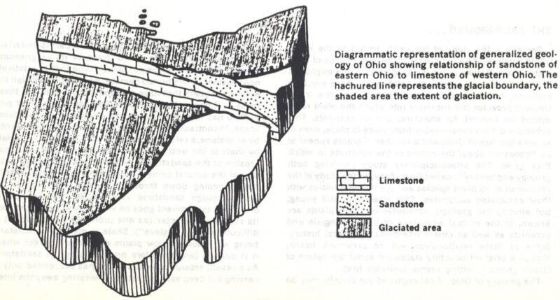
4. Describe “glacial till” in terms of its general composition (a definition of till), and how it differs in eastern and western OH.
Till is a mixture of sand, silt, clay and boulders. The composition reflects the nature of the geological materials over which the glacier moved. In western Ohio, the glacial till is rich in lime and clay. However, in eastern Ohio the till contains very little lime and clay, except near the margins of an area of sandstone hills.
5. Contrast the basic substrate for plants in western and eastern OH in terms of drainage, aeration, pH (limey versus acid) nutrient availability.
Western Ohio substrate is limy, clayey till which creates relatively impermeable soil. It is high in lime but poorly drained and inadequately aerated. Water does not soak in very fast, which creates low oxygen availability during wet periods. The supply of plant nutrients here is relatively abundant.
Eastern Ohio has very permeable sandstone bedrock, which produces a very acid, low-nutrient substrate that is especially dry on the tops of hills. There is a supply of moisture that is continually available and cool because it has percolated down through permeable sandstone from springs. The shale present beneath the sandstone also produces a generally acid low-nutrient substrate. This, however, is impermeable, which means surface water runs off. Where the sandstone is mantled by till, the amounts of clay and lime produce more nutrient-rich soils.
6. Name 5 species of trees/shrubs that have a distribution generally limited to limestone or limey substrates (such as Ohio’s Lake Erie islands).
- Redbud (Cercis canadensis)
- Red-cedar (Juniperus virginiana)
- Hackberry (Celtis occidentalis)
- Hawthorn (Crateagus mollis)
- Chinkapin oak (Quercus muehlenbergii)
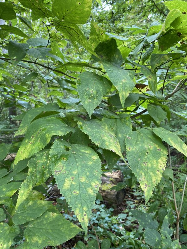
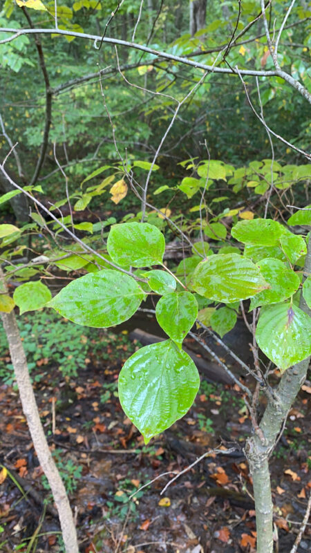
Hackberry (Celtis occidentalis) leaves characterized by splotchy coloring, serrated edges and a fine tip. This tree produces small, pea-sized berries that are edible. They were a popular food among indigenous groups and are continued to be eaten by many birds today.
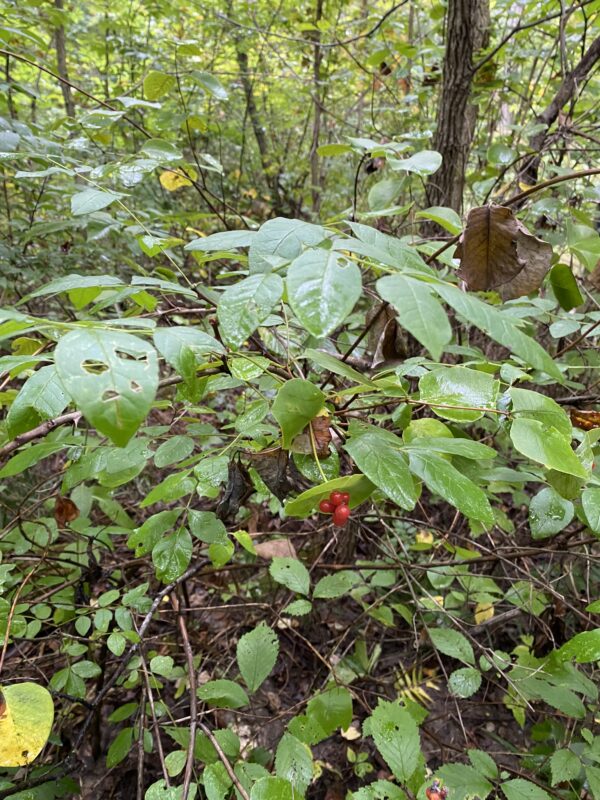
American honeysuckle (Lonicera canadensis) is native to the eastern United States! I had no idea that we had a native species of honeysuckle until this field trip. This species has white, tubular flowers and small red berries.
Blue ash (Fraxinus quadrangulata) has square edges of its branches with a square cross section.
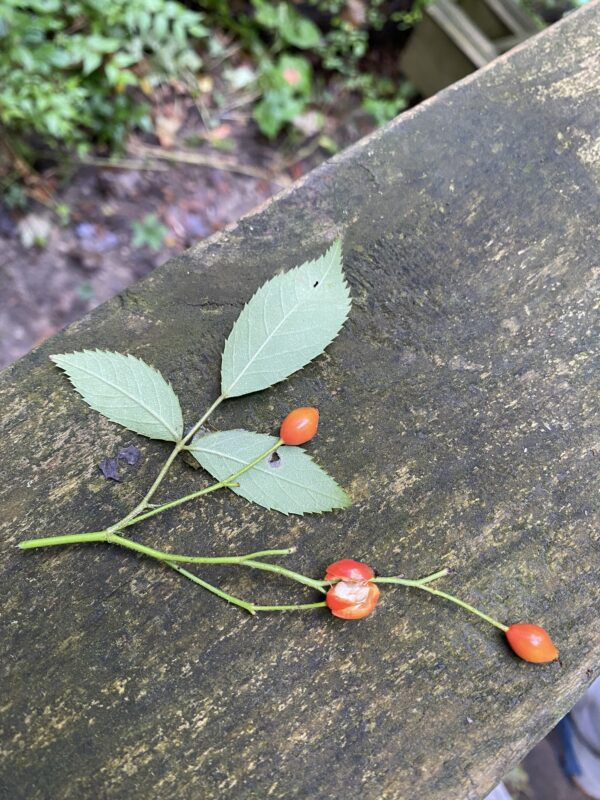
Multiflora rose (Rosa multiflora) is a thorny, perennial shrub that reaches up to 12 feet tall. It’s characterized by toothed leaflets and bright red, clustered fruits. This species is highly invasive in the U.S. and originates in Japan and Korea.
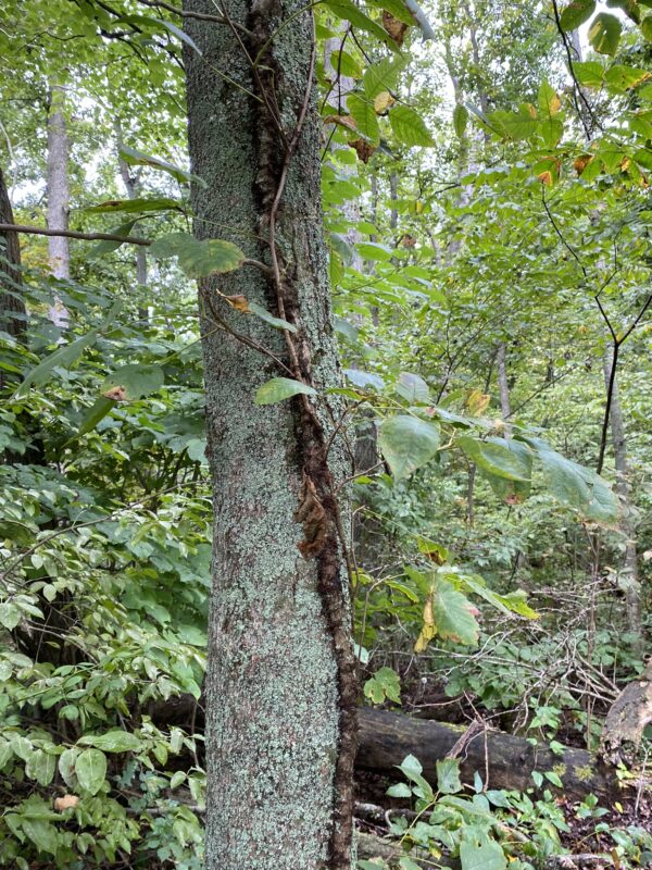
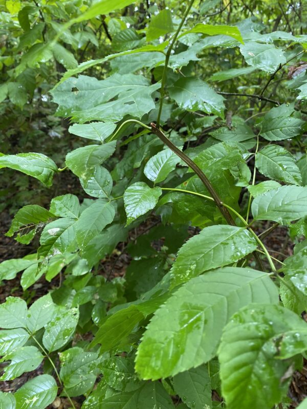
Virginia creeper (Parthenocissus quinquefolia) is a high climbing vine in the grape family. It’s characterized by a thin, slender root with five leaflets that are coarsely toothed and pointed at the tip. This species can be used as a climbing vine or as ground cover.
7. Name 5 species of trees/shrubs that have a distribution generally limited to high-lime, clay-rich substrates developed in the thick glacial till of western Ohio
- Sugar maple (Acer saccharum)
- Beech (Fagus grandifolia)
- Red oak (Quercus borealis)
- Shagbark hickory (Carya ovata)
- White oak (Quercus alba)
8. Name 5 species of trees/shrubs that have a distribution generally limited to sandstone hill of eastern OH
- Chestnut oak (Quercus montana)
- Sourwood (Oxydendrum arboreum)
- Scrub pine (Pinus virginiana)
- Mountain laurel (Kalmia latifolia)
- Greenbrier (Smilax glauca)
9. What is the major determinant of the distribution of each of these species: a) sweet buckeye (contrast with hemlock), b) hemlock (contrast with sweet buckeye, c) rhododendron?
Sweet buckeye does not grow anywhere within the glacial boundary. The reason for this is unclear, but may have something to do with problems of repopulation of the clayey, high-lime glacial tills since ice left Ohio. Additionally, climate may prevent it from growing in the eastern Ohio region.
Hemlock also grows in the unglaciated regions of Ohio, however it extends far to the north, including well north of the glacial boundary. This is likely because it is restricted to continuously cool, moist environments. These conditions can be found in deep valleys cut into sandstone in the south and valleys with some till in the north.
Rhododendron occurs south of the glacial boundary and might belong to the mixed mesophytic association, but they do occur everywhere throughout the unglaciated area. The ancient Teays river can explain their distribution. Rhododendron is one of several species that migrated down to the Teays river system from the Appalachian highlands. Glaciers then blocked the Teays river drainage and destroyed most of its valleys, but the plant species remain.
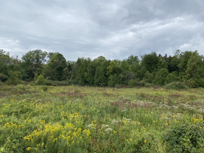
Part 2: Cedar Bog (that’s not a bog!)
Cedar Bog (or should I say Cedar Fen?)
During the second part of our field trip we visited Cedar Bog in Urbana, Ohio. Despite this site’s name, it is in fact not a bog! Bogs are characterized by water that enters via rain, but leaves mainly via evaporation. However, a fen is characterized by water that enters as rain and through springs, but water leaves via small streams that flush the system. Furthermore, groundwater contains dissolved limestone ad is alkaline in a fen. At Cedar Bog, water enters the system through surface runoff, groundwater filtering through gravel left by glacial hills, and deep groundwater following ancient Teays river valley. These are characteristics of a fen, not a bog!
This unique site was formed between 14,000 and 24,000 years ago when glaciers folded around the hills of Bellefontaine, the highest point in the state. Glacial hills known as end moraines were formed around Cedar Bog, leaving it in a valley. The moraines are mostly sand and limestone, which filters water through them and creates a great aquifer of cold ground water. This ground water helps maintain a unique habitat at Cedar Bog that sustains species not found anywhere else in the state.
Scavenger Hunt: Two flowering plants with bilateral symmetry
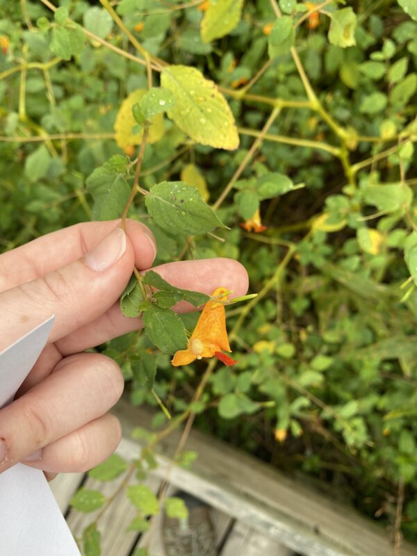
Plant 1: Common Jewelweed (Impatiens capensis)
This plant is commonly found growing in bottomland souls, ditches and along creeks. It’s characterized by bright orange, bilateral flowers that form a deep cupped shape. The name of this plant comes from how water droplets bead up on the leaves, forming a sparkling “jewel-like” appearance.
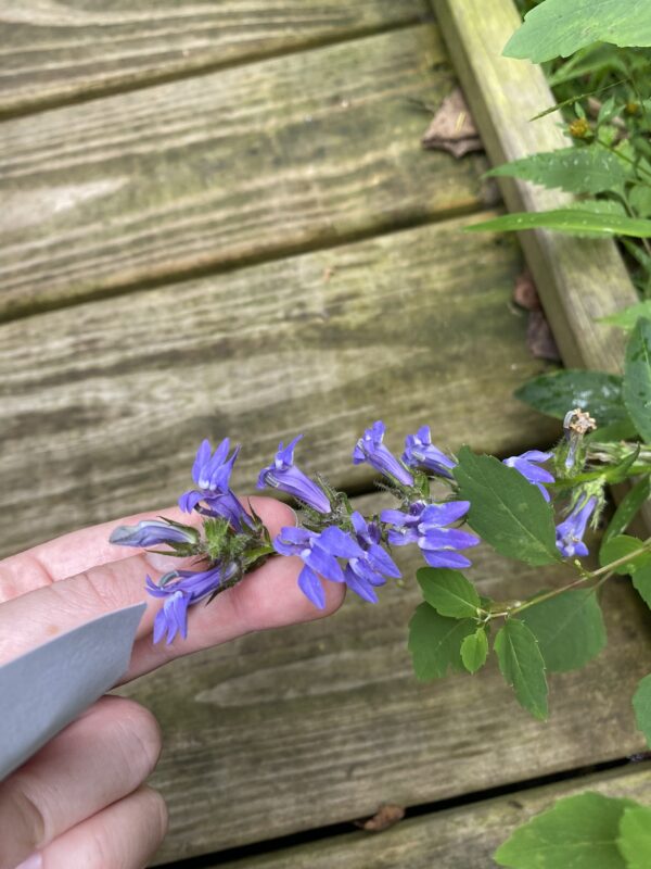
Plant 2: Great Blue Lobelia (Lobelia siphilitica)
This perennial plant produces lavender-blue tubular flowers that are crowded together on 2-3ft stems. Each flower is split into two lips, with two segments on the upper lip and three on the bottom lip (bilateral!). All parts of this plant are poisonous and should not be consumed, though it attracts birds and hummingbirds.
Four Plants and their Coefficients of Conservatism
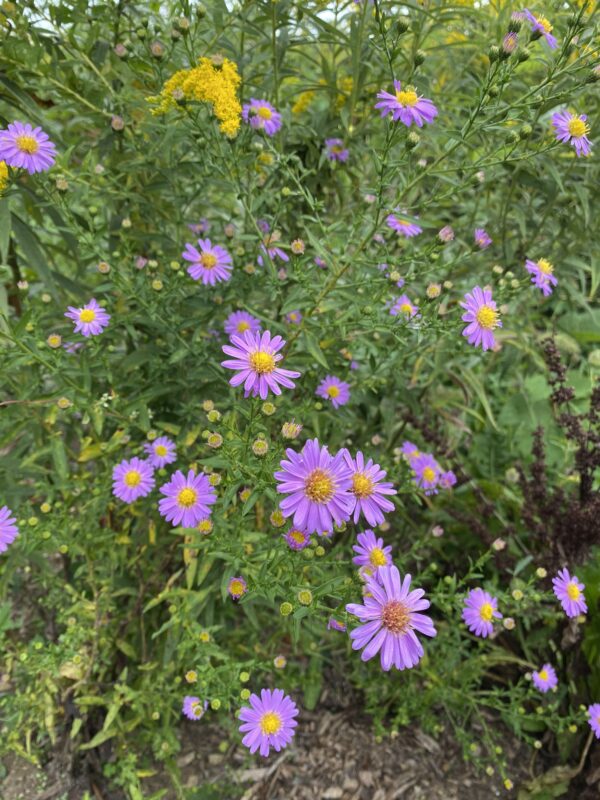
- Smooth aster (Aster laevis): 6
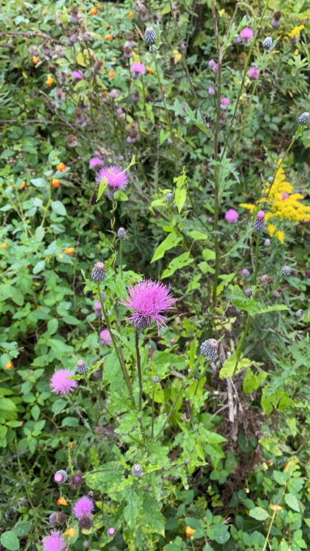
2. Swamp thistle (Cirsium muticum): 8
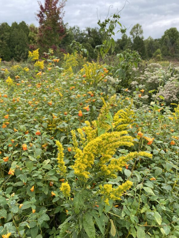
3. Canada goldenrod (Solidago canadensis): 1
4. Flowering dogwood (Cornus florida): 5
That’s all for now, thanks for checking out these plants with me! Tune in for the next field trip to discover more fun and exciting Ohio Plants 🙂